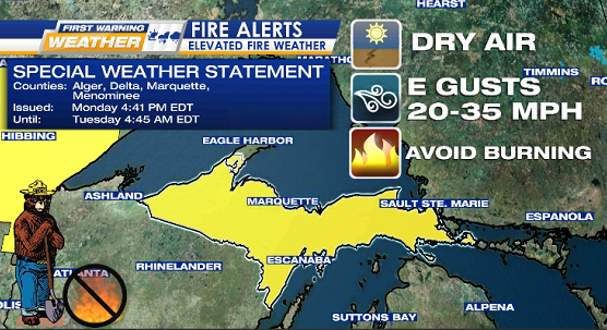
* ELEVATED FIRE WEATHER POTENTIAL *
WHEN Monday night into Tuesday
WHERE majority of the U.P. (all counties except Keweenaw)
WHAT gusty east winds 20-35 mph
Avoid burning & immediately report any wildfires by calling 911.
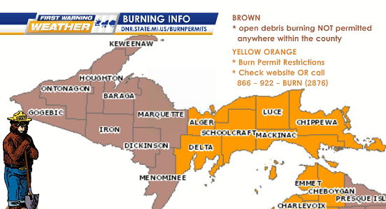
DNR burn restrictions in effect – for details visit https://www.dnr.state.mi.us/burnpermits/ or call 866-922-2876
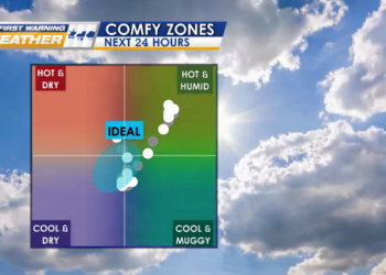
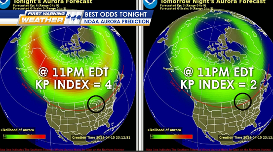
MATH TONIGHT mostly clear + calm winds = ideal Aurora Borealis Northern Lights viewing
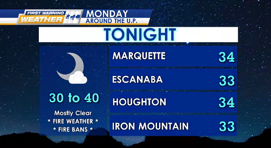
LOWS 30°s
AURORA BOREALIS / NORTHERN LIGHTS OUTLOOK
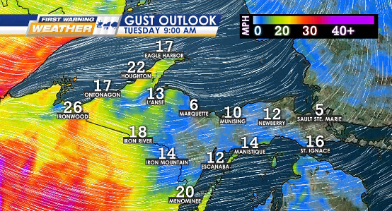
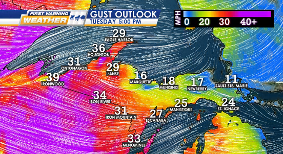
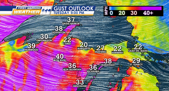
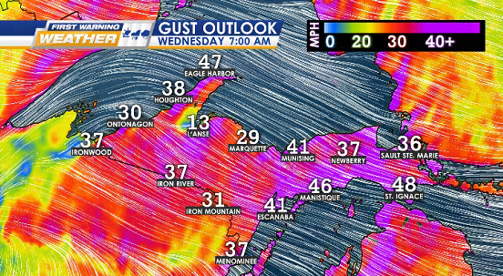
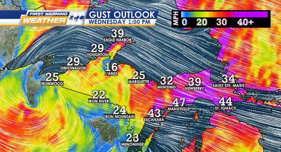
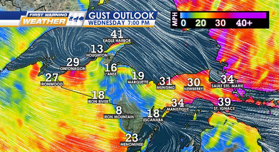
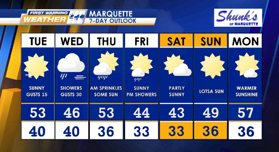
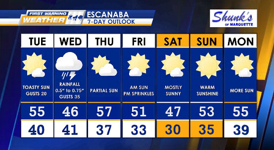
TUESDAY mainly sunshine, winds gust up (15-45 mph) along with late rain showers over us (possible thunderstorms) into WEDNESDAY.
HIGHS 55° to 65°
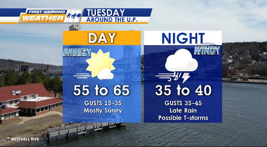
WIND GUSTS OUTLOOK