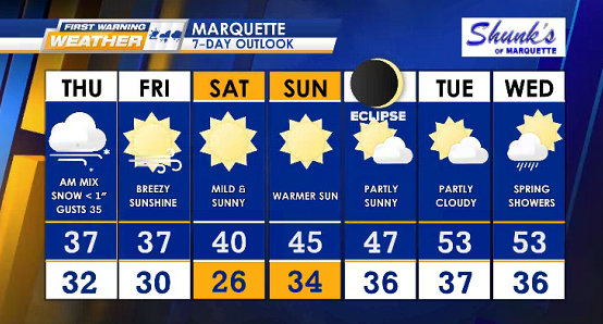
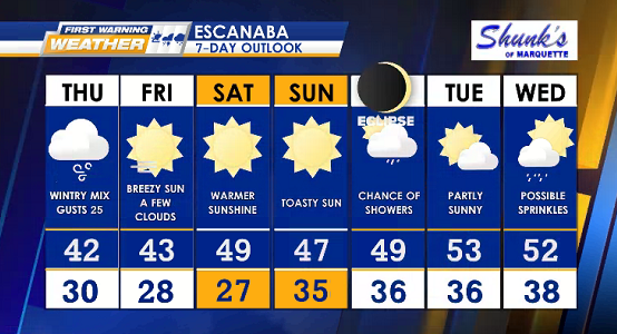
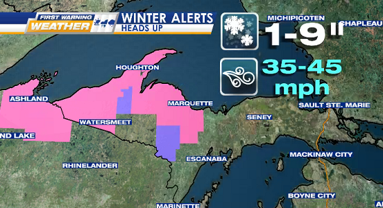
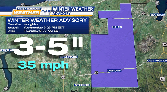
WEATHER ALERTS
WINTER STORM WARNINGS (end Thursday morning): Baraga, Gogebic, North Houghton, Keweenaw, Marquette, & Ontonagon
WINTER WEATHER ADVISORY (ends 8 AM EDT Thursday): South Houghton
![](https://wzmq19.com/wp-content/uploads/2024/04/ALERT-WINTER-STORM-WARNING-5.png)
![](https://wzmq19.com/wp-content/uploads/2024/04/ALERT-WINTER-ADV-1-1.png)
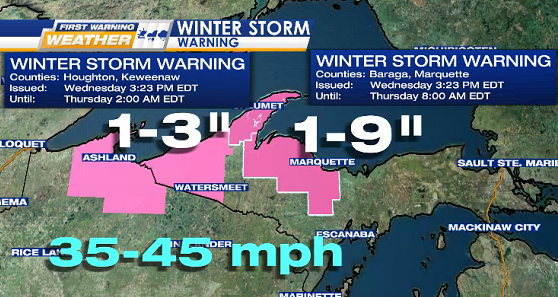
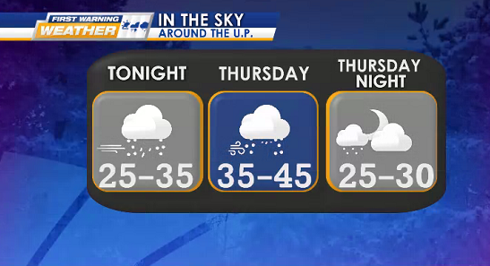
TONIGHT wintry mix, gusty winds (35-45 mph), & weather alerts continue into THURSDAY.
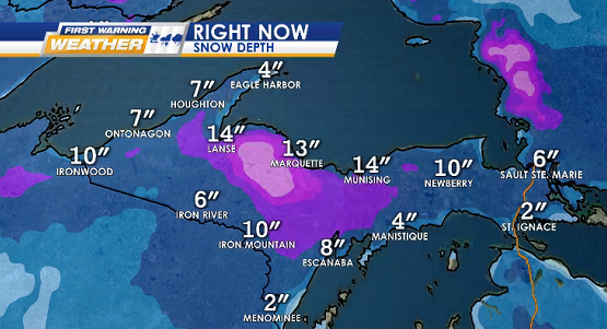
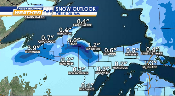
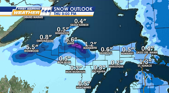
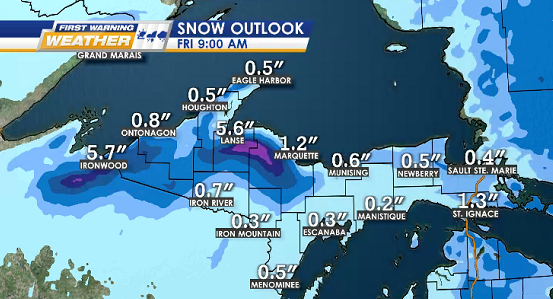
Biggest snowfall expected over Huron Mountains & Michigamme Highlands.
Lows: 25° to 35°
Highs: 35° to 45°
![](https://wzmq19.com/wp-content/uploads/2024/04/OUTLOOK-3-PANEL-BASIC-2.png)
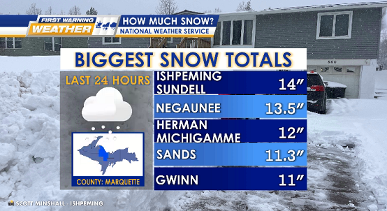
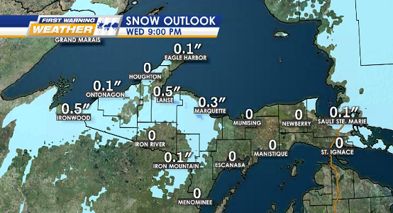
SNOW DEPTH, TOTALS, & OUTLOOKS ON THE 9s
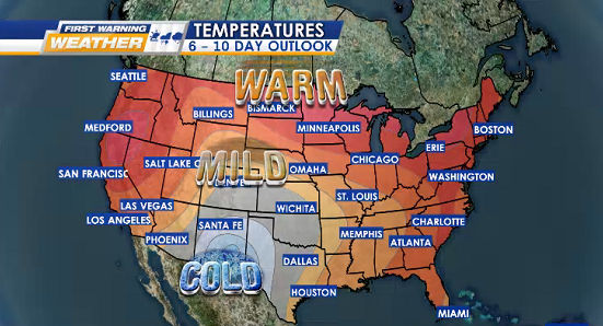
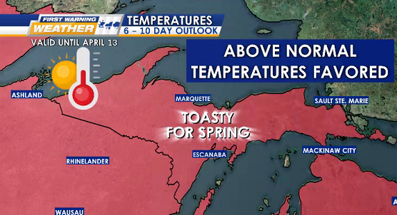
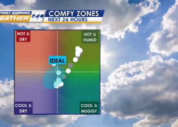
![](https://wzmq19.com/wp-content/uploads/2024/04/SNOW-TOTAL.png)
![](https://wzmq19.com/wp-content/uploads/2024/04/SNOW-DEPTH-NOW.png)
![](https://wzmq19.com/wp-content/uploads/2024/04/SNOW-1-3.png)
![](https://wzmq19.com/wp-content/uploads/2024/04/SNOW-2-4.png)
![](https://wzmq19.com/wp-content/uploads/2024/04/SNOW-3-2.png)
![](https://wzmq19.com/wp-content/uploads/2024/04/SNOW-4-2.png)
WARM TREND OUTLOOK
![](https://wzmq19.com/wp-content/uploads/2024/04/OUTLOOK-TEMPS-6-10-DAY-1.png)
![](https://wzmq19.com/wp-content/uploads/2024/04/OUTLOOK-TEMPS-6-10-DAY.png)
![](https://wzmq19.com/wp-content/uploads/2024/04/7-MQT-2.png)
![](https://wzmq19.com/wp-content/uploads/2024/04/7-ESC-2.png)