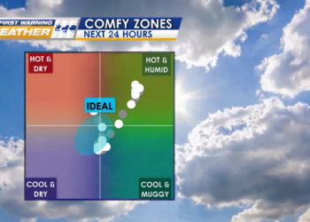
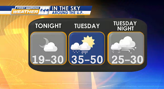
TONIGHT mostly clear – partly cloudy
Lows: 20°s (coldest west interior)
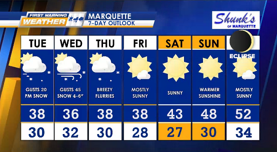
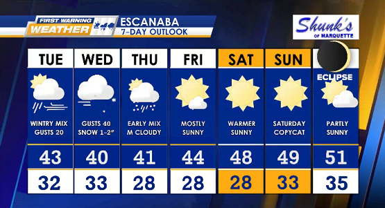
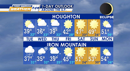
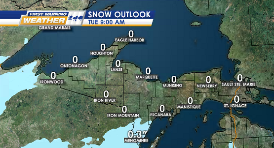
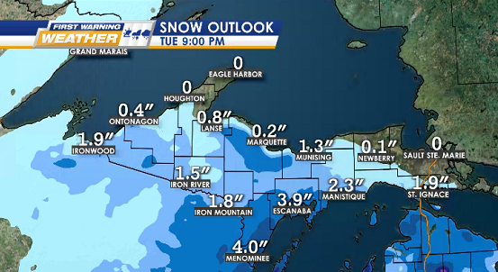
TUESDAY northern U.P. starts with partly sunny skies, southern U.P. will be cloudier as snow/rain mixture moves in mid-morning, winds speed up in the afternoon
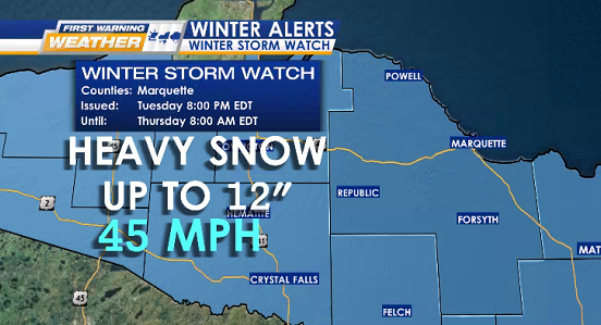
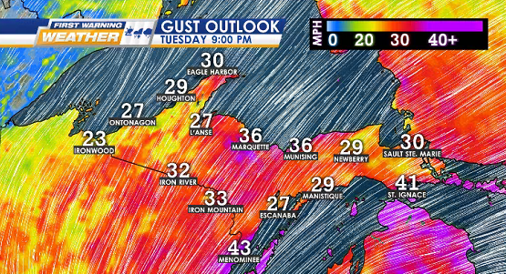
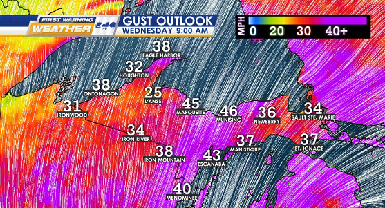
IMPACTS: possible slick commutes & potential power outages (gusts 35-50 mph)
Highs: 35° to 50°
Lows: 25° to 30°
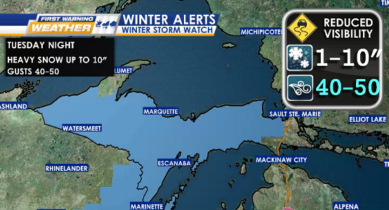
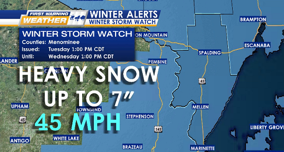
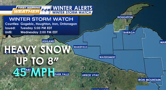
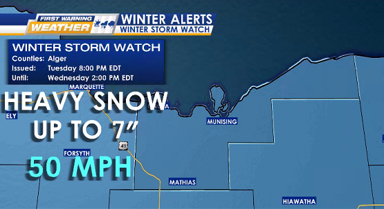
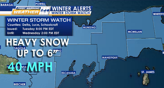
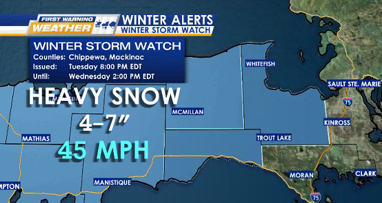
WINTER STORM WATCH
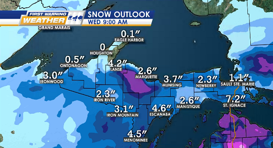
WHEN: Tuesday into Wednesday/Thursday
in order of start times

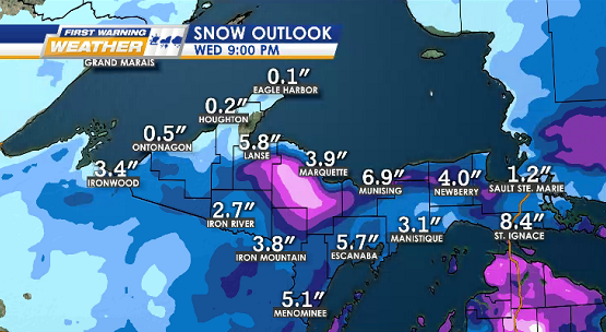
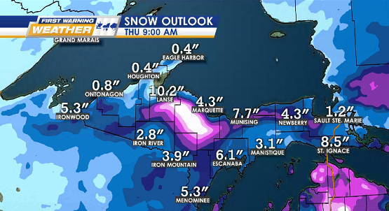
SNOW OUTLOOKS ON THE 9s
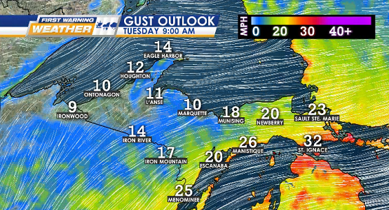
GUST OUTLOOKS ON THE 9s
MONDAY 4/8 Solar Eclipse