Our Summer preview is over & we’re back to our Winter/Spring mash-up!
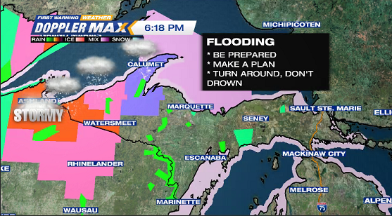
Expect slick roads tonight into Tuesday morning.
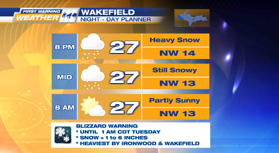
* BLIZZARD WARNING until 1 AM CDT Tuesday
– Gogebic county
– snow = 1 to 6 inches, heaviest in the west
* WINTER STORM WARNING until 2 AM EDT Tuesday
– Ontonagon county
– snow = 2 to 4 inches, heaviest in Porcupine Mountains
* WINTER WEATHER ADVISORY until 8 AM EDT Tuesday
– Baraga & Houghton counties
– snow = 3 to 5 inches
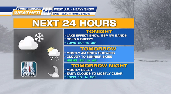
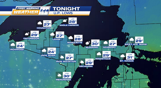
MONDAY NIGHT lake effect snow showers (mostly in NW), below freezing temps of 20° to 30°, blustery NW winds 10 to 25 mph (Gusts 35).