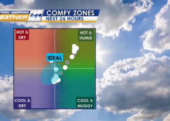
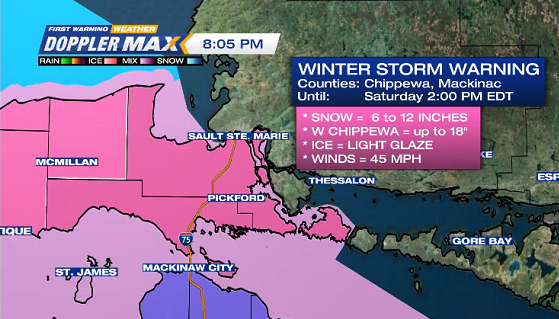
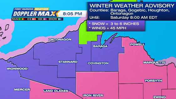
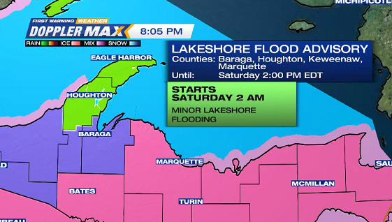
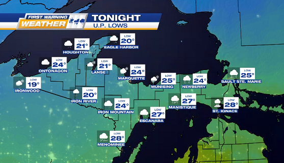
Slick & slushy roads TONIGHT into SATURDAY MORNING with anywhere from 1 to 18 inches of SNOW (highest totals expected in Central to Eastern U.P. counties), light glaze of ICE, & GUSTY NE WINDS up to 45 mph.
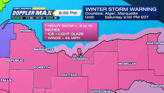
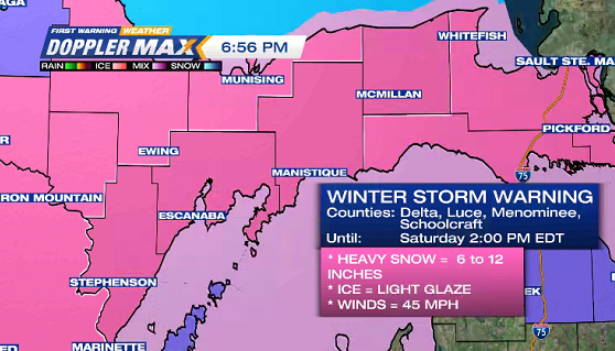
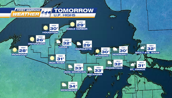
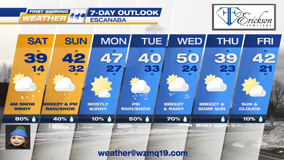
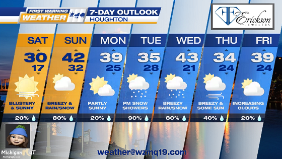
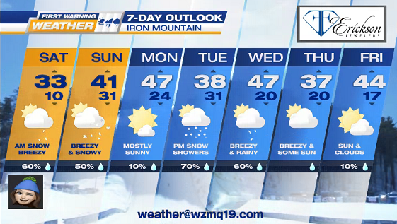
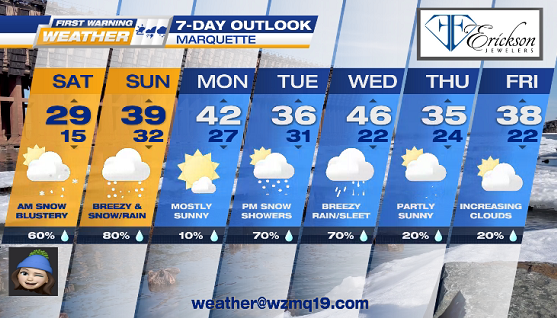
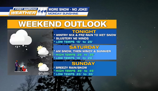
Slick & slushy roads TONIGHT into SATURDAY MORNING with anywhere from 1 to 18 inches of SNOW (highest totals expected in Central to Eastern U.P. counties), light glaze of ICE, & GUSTY NE WINDS up to 45 mph.
Download the app


Watch on TV


Connect on social media