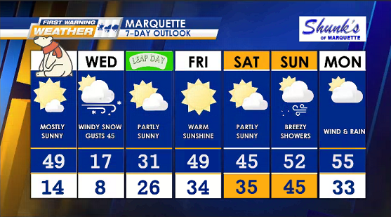
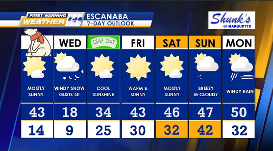
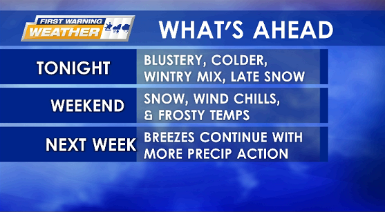
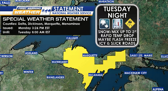
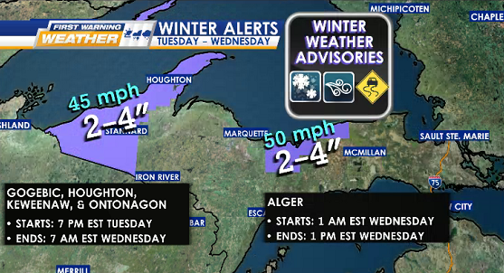
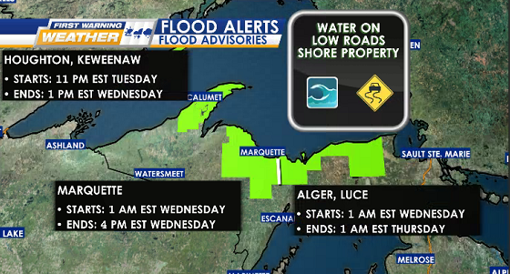
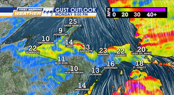
WEATHER ALERTS
![](https://wzmq19.com/wp-content/uploads/2024/02/ALERT-SPECIAL-STATEMENT.png)
![](https://wzmq19.com/wp-content/uploads/2024/02/ALERT-WINTER-ADV.png)
![](https://wzmq19.com/wp-content/uploads/2024/02/ALERT-FLOOD-ADV.png)
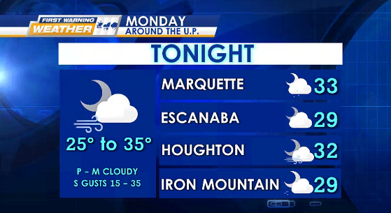
TONIGHT partly to mostly cloudy & S gusts 15-35 mph
Lows: 25° to 35° (coldest inland)
![](https://wzmq19.com/wp-content/uploads/2024/02/3-TONIGHT-4-CITIES-9.png)
![](https://wzmq19.com/wp-content/uploads/2024/02/GUSTS-1-6.png)
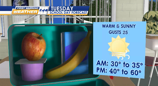
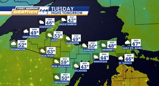
TUESDAY mostly sunny, gusts 15-25 mph, & possible afternoon rain (primarily eastern half)
Highs: 40° to 60° (coolest Keweenaw Peninsula, warmest inland)
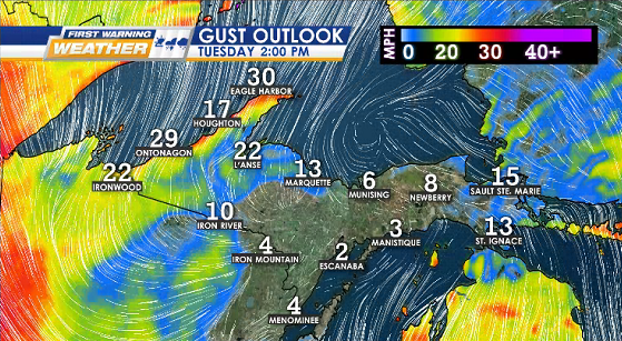
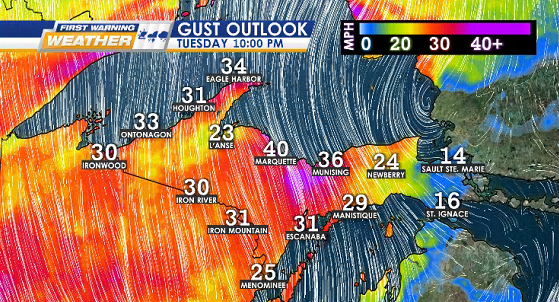
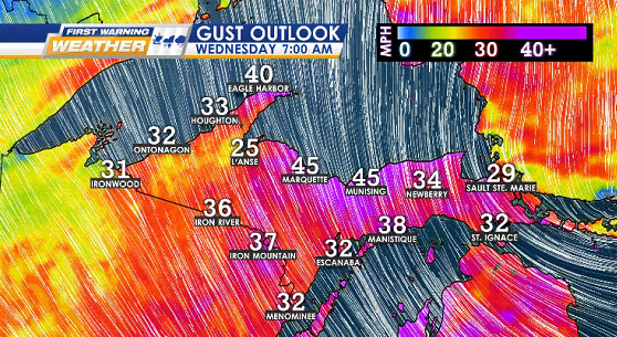
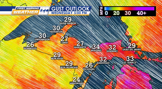
![](https://wzmq19.com/wp-content/uploads/2024/02/SCHOOL-LUNCH-BOX.png)
![](https://wzmq19.com/wp-content/uploads/2024/02/HIGHS-2.png)
![](https://wzmq19.com/wp-content/uploads/2024/02/GUSTS-2-5.png)
![](https://wzmq19.com/wp-content/uploads/2024/02/GUSTS-3-5.png)
WIND OUTLOOK
Wednesday 2/28
![](https://wzmq19.com/wp-content/uploads/2024/02/GUSTS-4-5.png)
![](https://wzmq19.com/wp-content/uploads/2024/02/GUSTS-5.png)
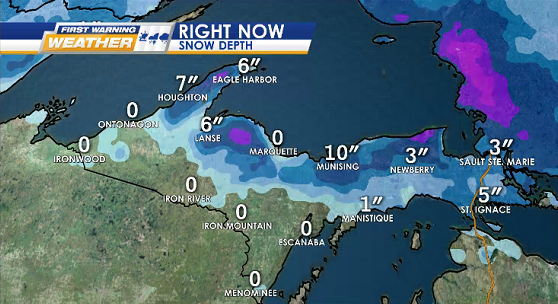
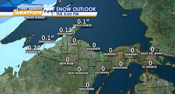
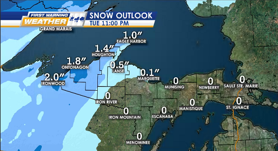
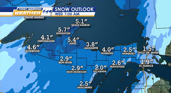
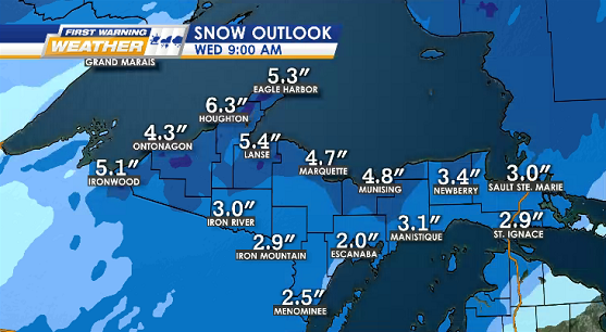
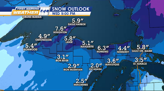
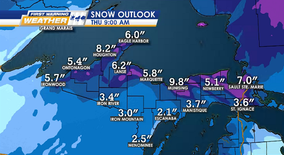
SNOWFALL CURRENT DEPTH & OUTLOOK
Tuesday 2/27 into Thursday 2/29
![](https://wzmq19.com/wp-content/uploads/2024/02/SNOW-DEPTH-NOW.png)
![](https://wzmq19.com/wp-content/uploads/2024/02/SNOW-1-6.png)
![](https://wzmq19.com/wp-content/uploads/2024/02/SNOW-2-4.png)
![](https://wzmq19.com/wp-content/uploads/2024/02/SNOW-3-5.png)
![](https://wzmq19.com/wp-content/uploads/2024/02/SNOW-4-5.png)
![](https://wzmq19.com/wp-content/uploads/2024/02/SNOW-5-2.png)
![](https://wzmq19.com/wp-content/uploads/2024/02/SNOW-6.png)
![](https://wzmq19.com/wp-content/uploads/2024/02/7-MQT-13.png)
![](https://wzmq19.com/wp-content/uploads/2024/02/7-ESC-13.png)