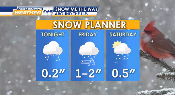
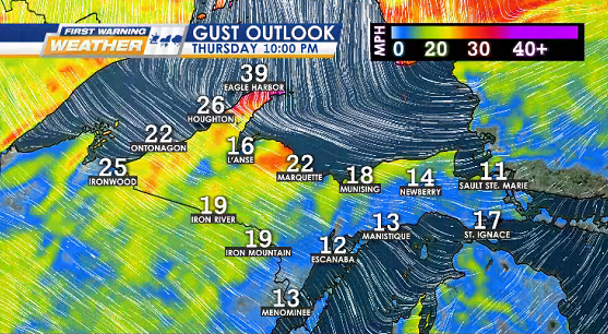
TONIGHT chances of early sprinkles or wintry mix, late snow showers (starting on NW coast), & blustery NW gusts up to 30 mph
Lows: 5° to 20° (coldest Keweenaw & west interior)

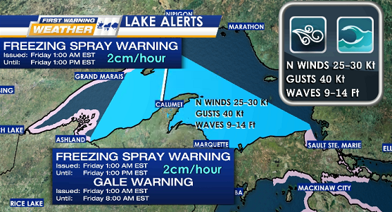
WEATHER ALERTS – Friday for Lake Superior
HEAVY FREEZING SPRAY WARNING – rate of 2 cm per hour or more on vessels
GALE WARNING – N winds 25-30 Kt, gusts up to 40 Kt, waves 9-14 Ft
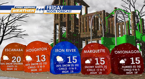
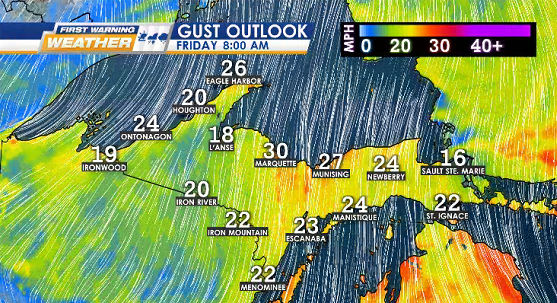
FRIDAY colder, blustery (gusts 20-30 mph), lake effect snow showers (1-2″ at the end of the day), & wind chills in single digits
Highs: 10° to 30° with temps dropping in the early evening
Lows: -5° to 15° (coldest inland)
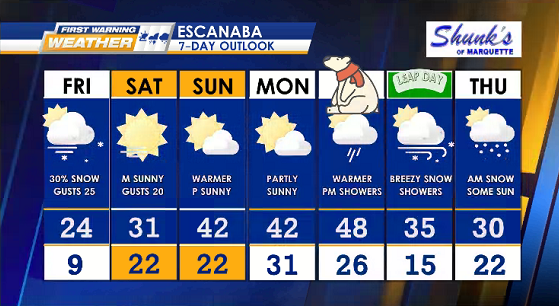
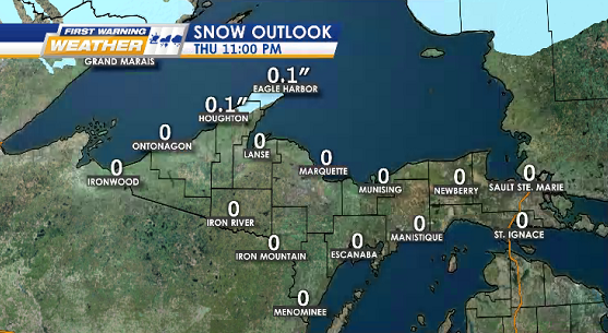
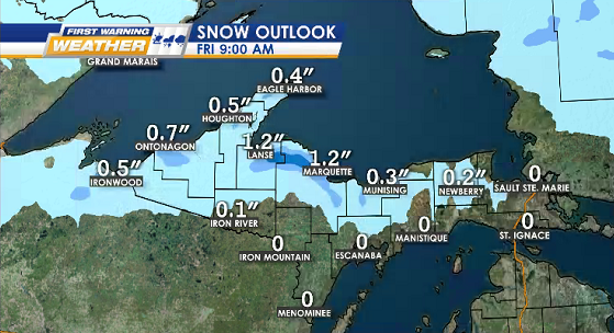
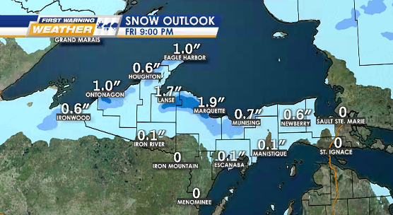
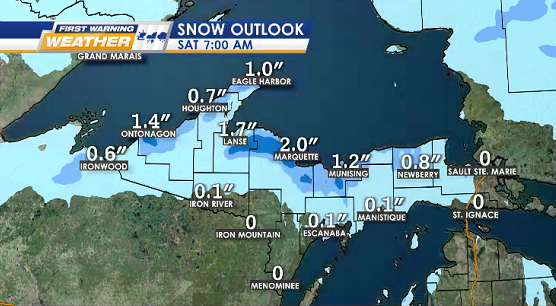
SNOW OUTLOOK – Thursday into Saturday
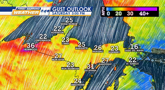
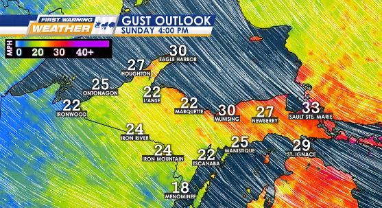
GUST OUTLOOK – Thursday into Saturday
TUESDAY 2/27 International Polar Bear Day
WEDNESDAY 2/28 Leap Day