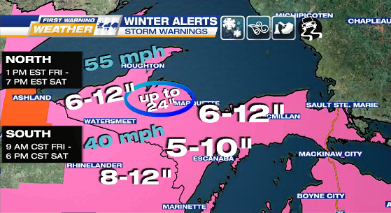
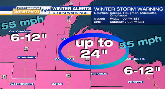
WINTER STORM WARNING
Likely snowfall piling up FRIDAY into SATURDAY as our first legit Winter Storm blows in with arctic temps.
Central U.P. counties in the 90% range for at least 6-inches of snow.
North winds gusting 35-55 mph, so expect hazardous travel & possible power outages.
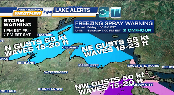
LAKE ALERTS – Friday into Saturday
FREEZING SPRAY WARNING: heavy freezing spray of 2 cm per hour or greater, rapid accumulations
GALE WARNING: gusts up to 50 kt & waves up to 20 ft
STORM WARNING: gusts up to 55 kt & waves up to 25 ft
TONIGHT mostly cloudy & possible flurries
Lows: 5° to 25°

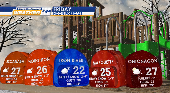
FRIDAY windy snow (heavy at times) with N wind gusts 30-35 mph before speeding up in the evening.
Highs: 20° to 30°

SNOW OUTLOOKS