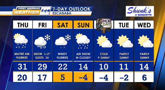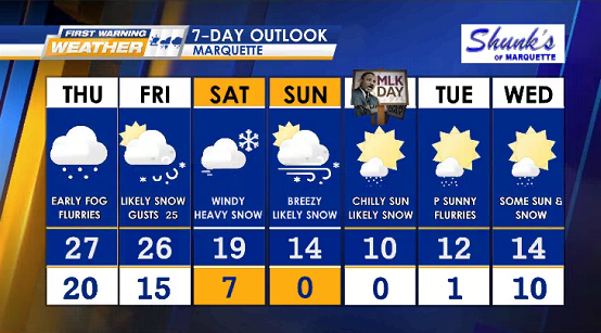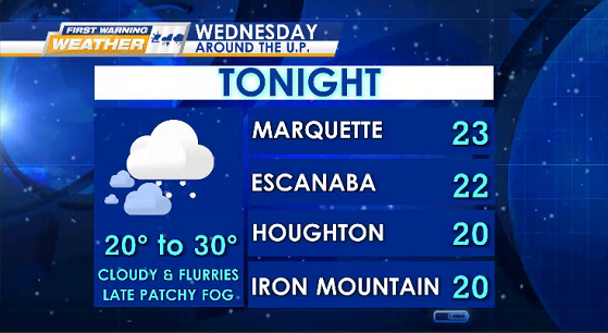
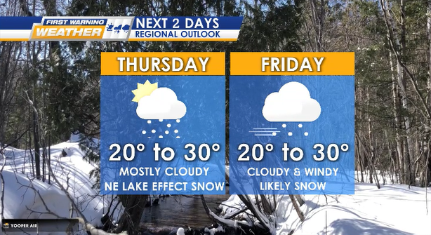
Light lake effect snow showers continue this week, dusting mainly blowing in from the NNE off Lake Superior.
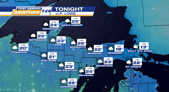
TONIGHT‘s lows: 15° to 25°.
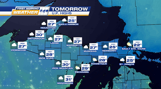
THURSDAY & FRIDAY flurries & mostly cloudy (some sun for the east half). Highs: 20°s
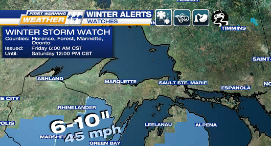
HEADS UP: potentially strong winter storm headed our way Friday night into Saturday with wet & heavy snow, plus very gusty gales & wind chills.
WINTER STORM WATCH
WHEN: 6 a.m. CST Friday until 12:00 p.m. CST Saturday
WHERE: Wisconsin counties of Florence, Forest, Marinette, & Oconto
WHAT: heavy snow accumulations (6-10 inches) & wind gusts (40-50 mph)
IMPACTS: travel issues, whiteout conditions, blowing/drifting snow, & power outages