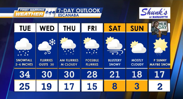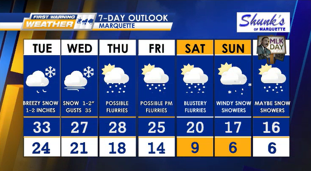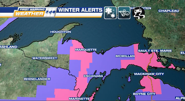
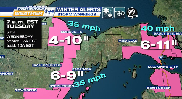
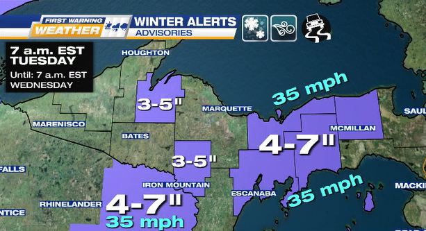
* WINTER STORM WARNINGS & ADVISORIES *
TUESDAY into WEDNESDAY for central & eastern U.P. with moderate-heavy snowfall & gusty NNE winds.
Get errands & storm prep done early as heaviest snow starts dropping after 5 p.m. EST on TUESDAY NIGHT.
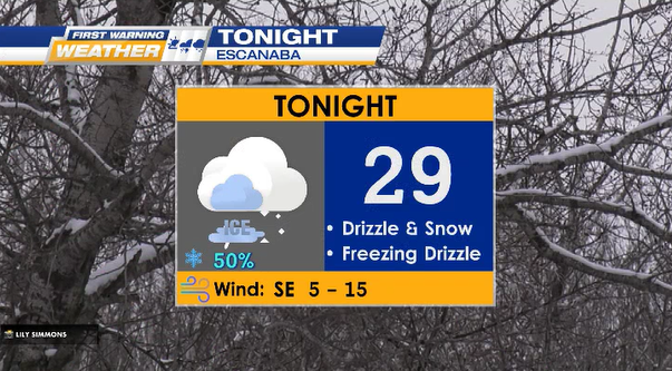
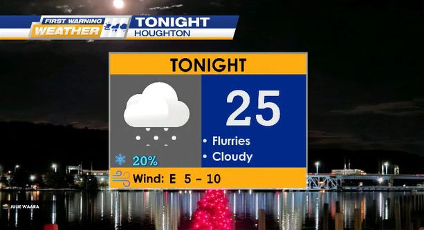
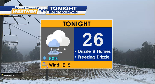
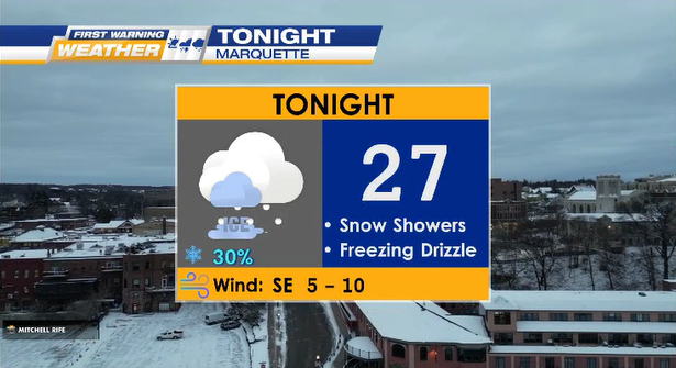
TONIGHT flurries, drizzle, & possibly freezing drizzle.
Lows: 20° to 35°

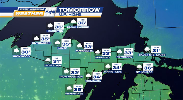
TUESDAY cloudy, snowy & breezy N winds (gusts 35-40 mph).
Highs: 30° to 35°
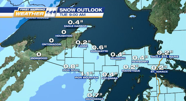
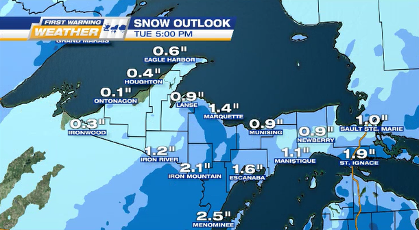
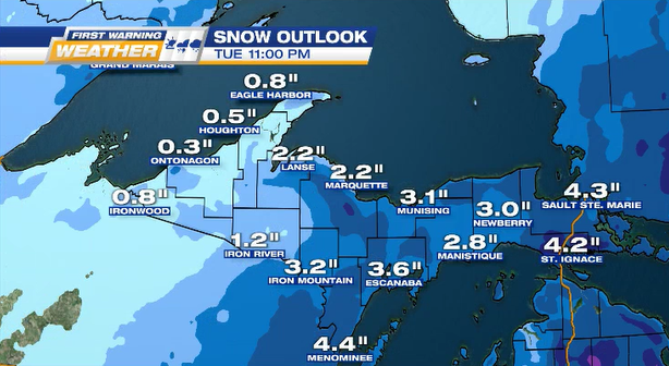
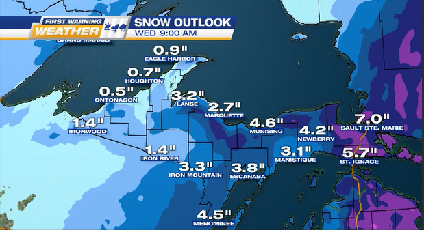
SNOW OUTLOOK