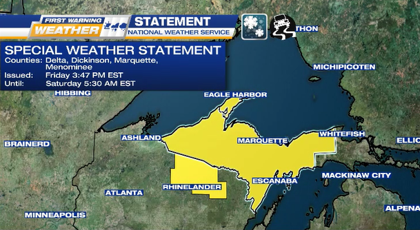
SPECIAL WEATHER STATEMENT from the National Weather Service
WHEN: tonight until 5:30 a.m. EST Saturday
WHERE: all U.P. counties except Chippewa & Mackinac Counties, north-central Wisconsin
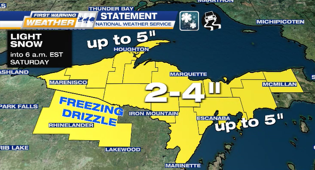
WHAT: light snowfall (2 to 4 inches into Saturday night), possibly up to 5-inches (Keweenaw Peninsula & from Escanaba to Manistique), plus freezing drizzle & light ice glaze (north-central Wisconsin & along Michigan-Wisconsin (“Misconsin”) border)
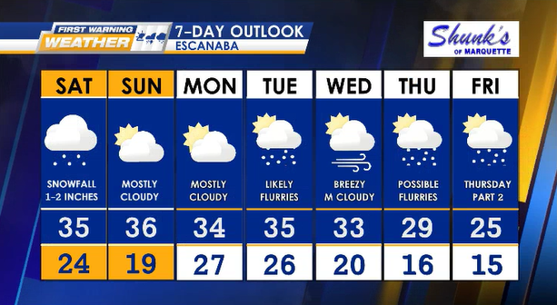
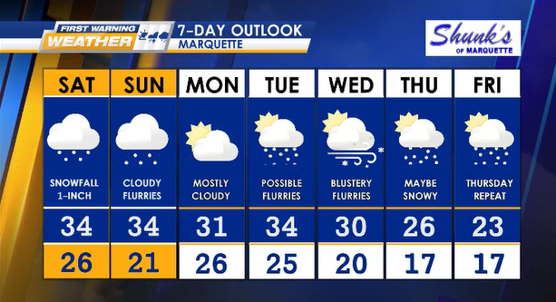
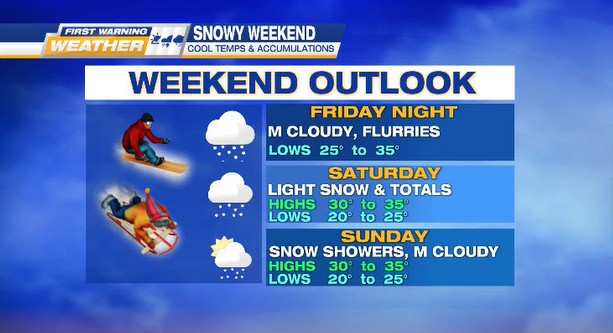
WEEKEND OUTLOOK: flurries & clouds cover the U.P.
Highs: 30° to 35°
Lows: 20° to 25°
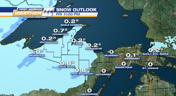
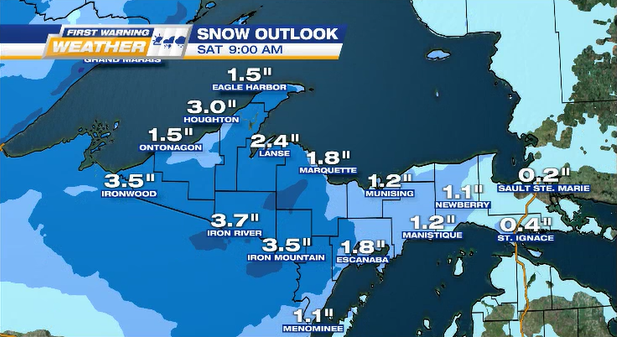
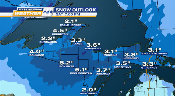
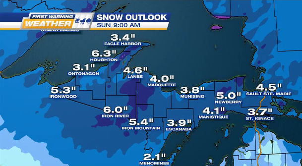
SNOWFALL OUTLOOK
The National Weather Service predicting the biggest weekend snow totals likely be in the Keweenaw Peninsula & along Lake Michigan coastline from Escanaba to Manistique.
Large snow piles possible for west interior counties: Dickinson, Gogebic, & Iron