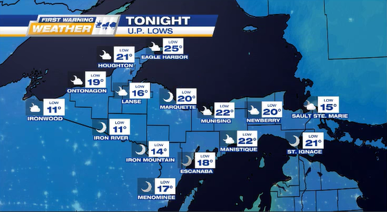
Clouds decrease TONIGHT as temps drop into single digits for the west interior. Lows: 5 to 20°.
HAZARDOUS TRAVEL: for NNW wind snow belts with blowing snow & accumulations, plus possible minor flooding for Lake Superior coast from Marquette to Grand Marais.

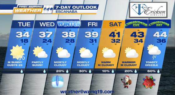
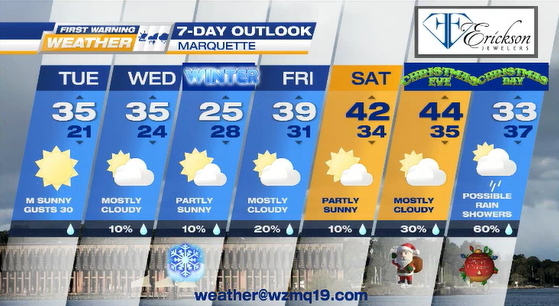
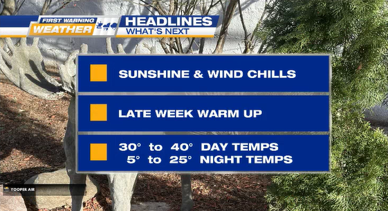
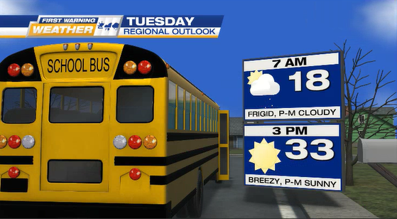
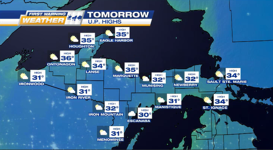
TUESDAY starts chilly & mostly cloudy before warmer afternoon temps in the 30°s & partly-mostly sunny skies.
AVERAGE TEMPS: @ 7 a.m. around 18° and @ 3 p.m. about 33°
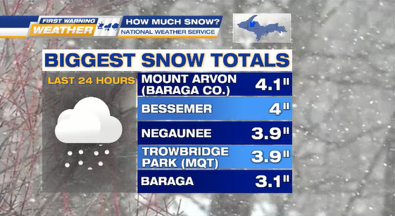
SNOWFALL TOTALS