WEATHER ALERTS
Strong NW gusting lake effect snow over the majority of the U.P. TONIGHT into TUESDAY.
Expect slick roads & reduced visibility, especially along Lake Superior coastlines.
Current weather alerts are listed below.
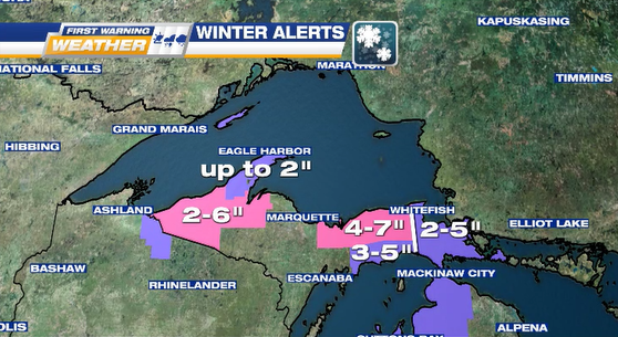
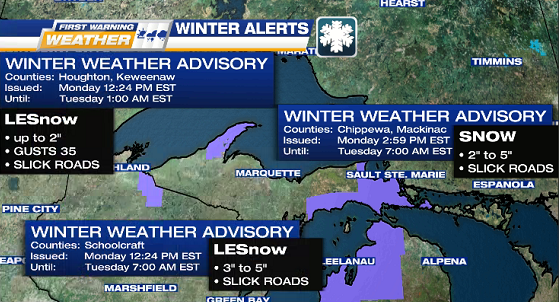
WINTER STORM WARNINGS
1 of 2 WINTER STORM WARNING: heavy snowfall (2 to 6 inches) for Baraga, Gogebic, Houghton, & Ontonagon Counties.
2 of 2 WINTER STORM WARNING: heavy snowfall (4 to 7 inches, localized up to 10 inches) & gusts 35 mph for Alger, Luce, & North Schoolcraft Counties.

WINTER WEATHER ADVISORIES
1 of 3 WINTER WEATHER ADVISORY: lake effect snowfall (up to 2 inches) & gusts 35 mph for Houghton & Keweenaw Counties.
2 of 3 WINTER WEATHER ADVISORY: lake effect snowfall (3 to 5 inches) for South Schoolcraft County.
3 of 3 WINTER WEATHER ADVISORY: snowfall (4 to 6 inches) for Chippewa & Mackinac Counties.
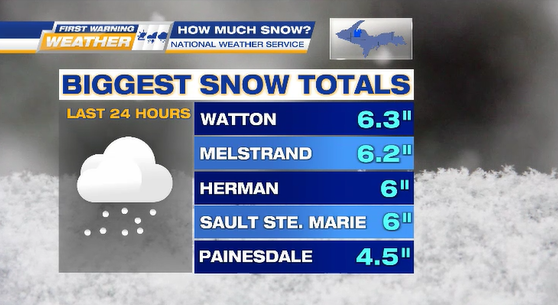
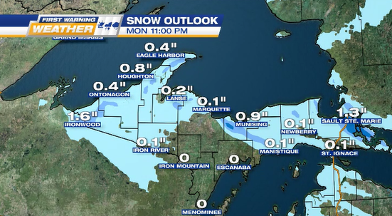
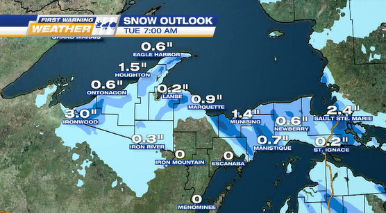
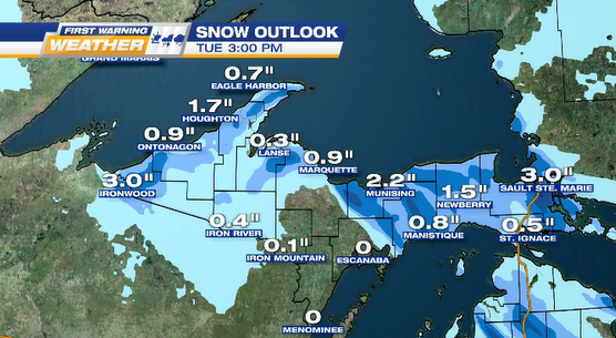
SNOWFALL
PAST 24 HOURS
PROJECTED OUTLOOKS
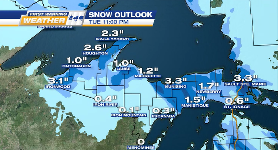
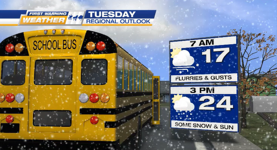
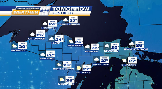
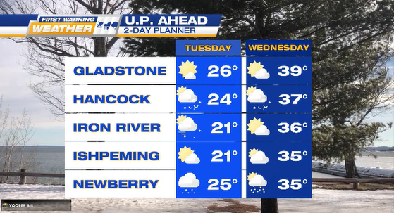
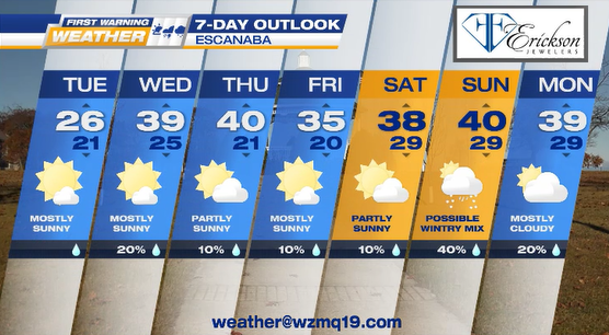
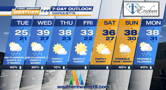
TUESDAY layer it on because this looks to be the chilliest day for this week with highs 15° to 30°, partly – mostly cloudy for majority of the U.P. with more sunshine forecasted for Delta & Menominee Counties.
We should be “warmer” on Wednesday & Thursday.