Very vibrant map season is on!
Please drive slow, avoid distractions, & be safe out there: it’s gonna get slick on the roads.
Frigid temps & strong NW winds are teaming up with lake effect snow TODAY into TUESDAY.
Moderate to heavy snow is possible for the NW wind snowbelts, especially downwind of Lake Superior.
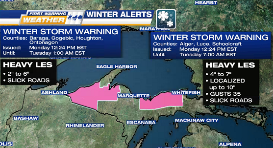
WINTER STORM WARNING
WHEN: today into TUESDAY morning
WHERE: Alger, Baraga, Gogebic, Houghton, & N Schoolcraft Counties
WHAT: wind gusts up to 35 mph & heavy lake effect snowfall (check map image below) between 2 inches up to 7 inches, possibly up to 10 inches in localized areas in Alger, Luce & N Schoolcraft Counties

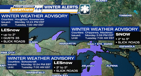
WINTER WEATHER ADVISORY
WHEN: today into TUESDAY morning
WHERE: Chippewa, Houghton, Keweenaw, Mackinac, S Schoolcraft Counties
WHAT: blowing lake effect snowfall (check map image below) anywhere from 2 inches up to 5 inches
IMPACTS: slick roads, reduced visibility
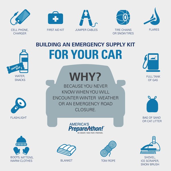
VEHICLE EMERGENCY SUPPLY KIT per the National Weather Service
Now is the time to build or check yours.
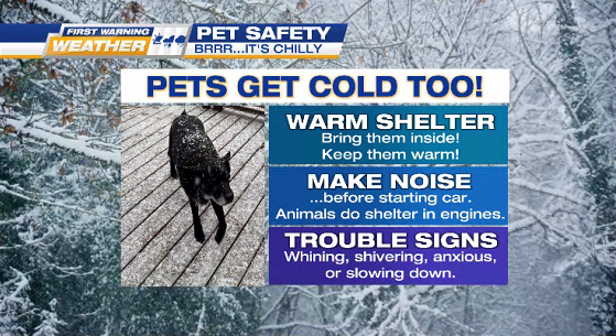
WINTER WEATHER PET SAFETY