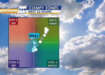
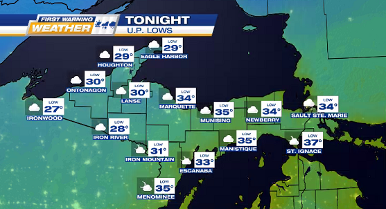
Clouds move in TONIGHT while we chill in the 20°s, which will be part of our highs range for the northern half the U.P. on THANKSGIVING THURSDAY!
![](https://wzmq19.com/wp-content/uploads/2023/11/3-LOWS-15.png)
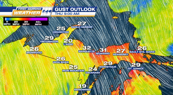
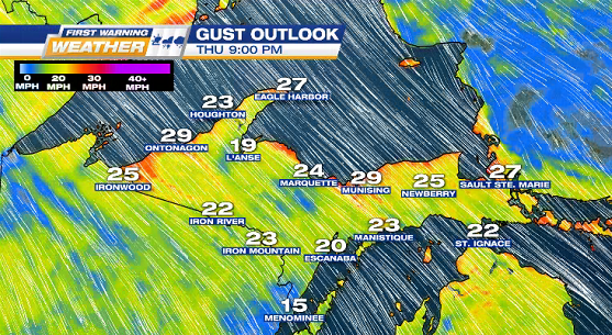
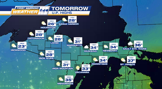
THURSDAY / THANKSGIVING
Blustery NW winds for entire U.P. with gusts 25-30 mph.
NORTH: chilly highs 25° to 30°, partly-mostly cloudy, & some Lake Superior flurries along the snowbelts.
SOUTH: cold highs 30° to 40° & partly-mostly sunny.
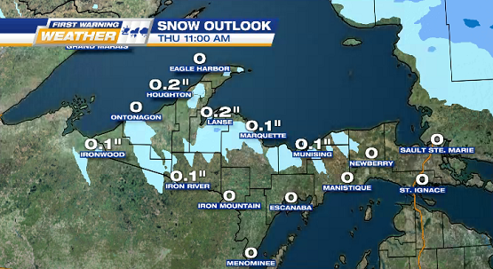
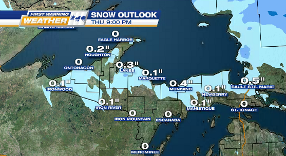
![](https://wzmq19.com/wp-content/uploads/2023/11/WIND-2-1.png)
![](https://wzmq19.com/wp-content/uploads/2023/11/WIND-3-1.png)
![](https://wzmq19.com/wp-content/uploads/2023/11/4-HIGHS-17.png)
SNOW OUTLOOK
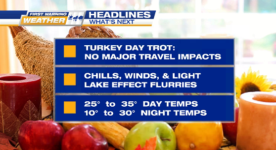
THURSDAY: light dusting
FRIDAY: some accumulations possible in Alger County (1.5″ in Munising) & Chippewa County (4.5″ in Sault Ste. Marie)
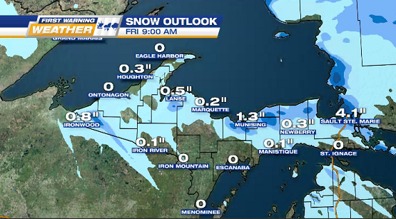
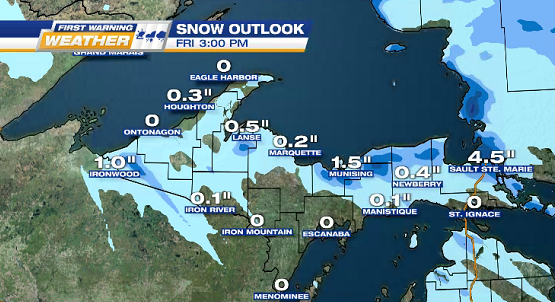
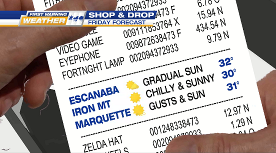
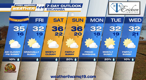
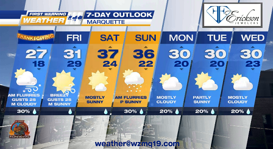
![](https://wzmq19.com/wp-content/uploads/2023/11/SNOW-1.png)
![](https://wzmq19.com/wp-content/uploads/2023/11/SNOW-2.png)
![](https://wzmq19.com/wp-content/uploads/2023/11/SNOW-3.png)
![](https://wzmq19.com/wp-content/uploads/2023/11/SNOW-4.png)
FRIDAY
![](https://wzmq19.com/wp-content/uploads/2023/11/FRIDAY-SHOP-DROP-112223.png)
![](https://wzmq19.com/wp-content/uploads/2023/11/7-ESC-14.png)
![](https://wzmq19.com/wp-content/uploads/2023/11/7-MQT-14.png)