Warm front will spread a mix of sleet/rain/freezing rain to the U.P. near midday tomorrow. This mix will continue to affect the area until the morning hours Saturday. Hazardous driving possible in this time period. Will see a break from the precipitation Saturday afternoon, then some snow for Saturday night into Sunday. Not much accumulation. The ice is the biggest weather threat through the early part of the weekend.
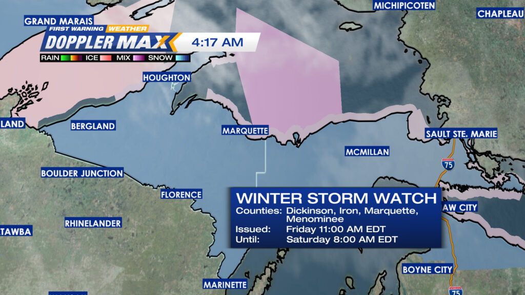
WINTER STORM WATCH CONTINUES TO BE IN EFFECT FOR THE U.P.
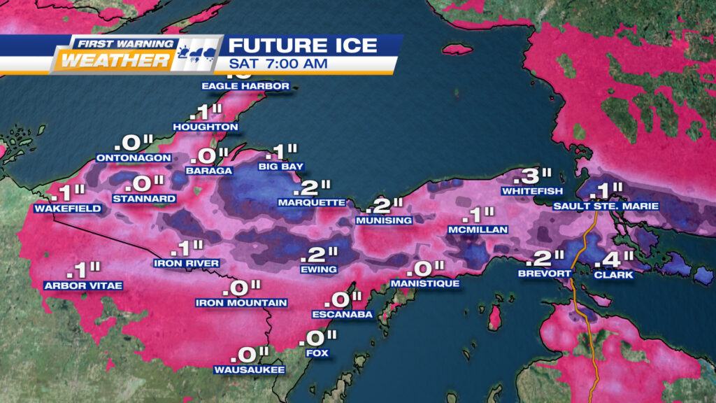
LATEST POTENTIAL ICE ACCUMULATIONS. GENERALLY A WIDER COVERAGE, THOUGH HIGHEST AMOUNTS HAVE DROPPED A BIT
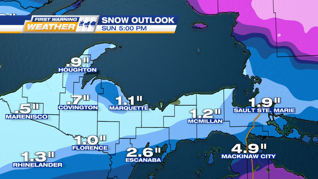
THIS STORM DOES NOT APPEAR TO BE A BIG SNOW EVENT. THIS IS A STORM TOTAL FROM LATE FRIDAY TO LATE SUNDAY AFTERNOON