We get one more decent day in the region today. Warm front slowly moving north out of Wisconsin will set off a variety of weather tomorrow afternoon. Mainly light mix of freezing rain/sleet and snow. This mix will pick up tomorrow night, and things could get icy into early Saturday morning. Winter Storm Watch is in effect for midday Friday into early Saturday, mainly for the ice potential. Precipitation slows for Saturday, but picks up again Saturday and Sunday with the next wave. This wave looks more like snow. Snow amounts not very high based on current thinking, but that could change again depending on the track of the front and the waves that ride along it. In a nutshell, expect a variety of weather Friday into the Weekend. Hazardous driving possible, especially late Friday into Friday night.
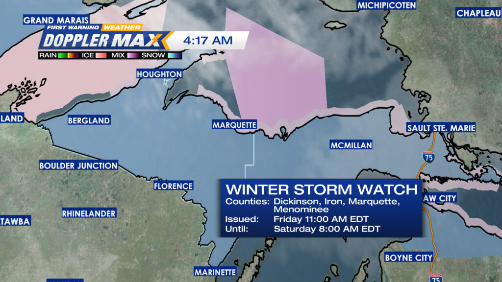
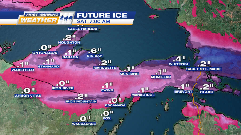
ICE POTENTIAL LATE FRIDAY AFTERNOON THROUGH DAYBREAK SATURDAY. SOME SIGNIFICANT ICE POSSIBLE, ESPECIALLY ALONG LAKE SUPERIOR
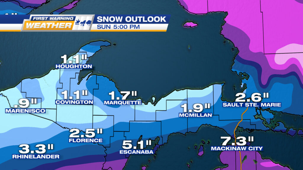
NOT A LOT OF SNOW EXPECTED FOR THE WEEKEND, BUT THAT COULD CHANGE WITH THIS EVOLVING SYSTEM