A stationary frontal system will be just south of the U.P. for Friday into the weekend. This placement will allow for the potential of a wintery (or freezing) mix. Best chance of this freezing mix appears to be from midday Friday into early Saturday morning. There is potential for some decent ice accumulation, along with some snow. We will get a break later Saturday and Saturday night. On Sunday, another wave will set off what for now looks like snow, with some wintery mix. This is a fluid situation, and thinking could very well change in the next day or two. For now, expect a variety of weather for the U.P. this weekend.
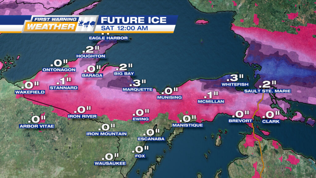
ICE POTENTIAL FROM MIDDAY FRIDAY TO MIDNIGHT FRIDAY NIGHT. COULD GO INTO EARLY SATURDAY MORNING
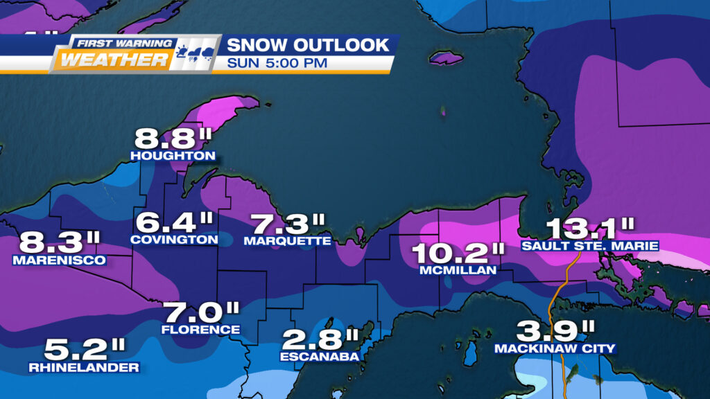
POTENTIAL TOTAL SNOW FOR THE THREE DAY PERIOD FRIDAY MORNING TO SUNDAY AFTERNOON. MOST OF THE SNOW ON SUNDAY.