High pressure gives the U.P. some decent sunshine today, and a corresponding rise in temperatures. Weak wave may set off a few evening showers. Cold front passes through tomorrow, mainly dry with some clouds. That front will stall in Wisconsin, then move north for the weekend. This will give us a variety of weather, with a freezing mix Friday into early Saturday, then mainly snow Sunday based on what we know now. Keep tuned as this is an evolving system, and thinking may change in the next day or so.
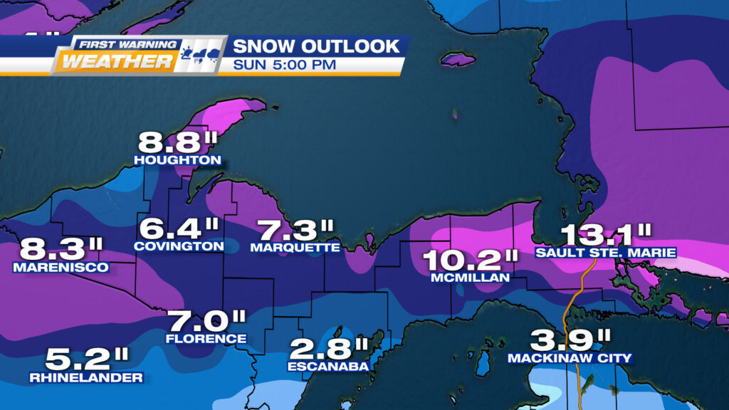
POSSIBLE TOTAL SNOWFALL FROM FRIDAY MORNING THROUGH THE END OF THE DAY SUNDAY.