Winter Storm Warning from 3pm this afternoon to 5am Thursday Morning. Snow and a mix just starting to fall in the southern end of the UP. This will eventually overspread the U.P., especially the eastern 2/3, by late afternoon. Snow will be heavy at times, and there may be some sleet and freezing rain mixed in, which would slicken up the roadways. Snowfall amounts a little tricky, with noticeable differences between models (as shown here on this site). So, Marquette expected to get about 6-10″ total by Thursday morning. Wind gusts will approach 40 mph this evening, creating very difficult driving conditions. Travel not recommended tonight in the warning area. Snow tapers off after midnight in Marquette, and toward daybreak farther east. Spring begins tomorrow both cold and windy.
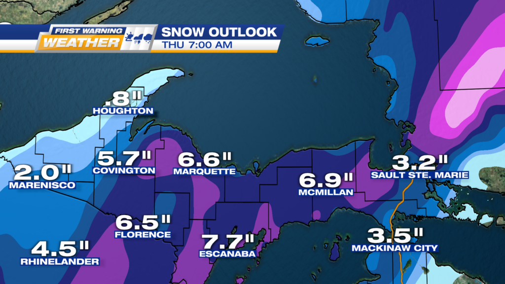
ONE POTENTIAL SCENARIO FOR TOTAL SNOWFALL, WITH THE HIGHER RANGE FARTHER WEST
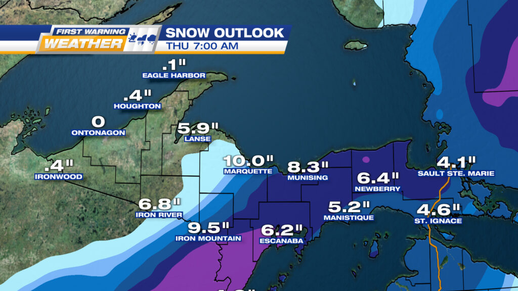
A SECOND SCENARIO, WITH MARQUETTE JUST ON THE EDGE OF THE HEAVY SNOW.
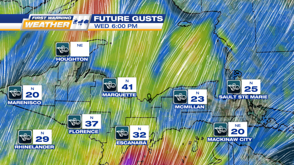
REGARDLESS OF HOW MUCH SNOW, BLOWING AND DRIFTING EXPECTED WITH THESE HIGH WIND GUSTS