Nice return flow of air for the day, allowing for temperatures to rise to near 40 by the afternoon. A few flakes of snow now and then into tomorrow. Large storm system will approach Tuesday night, giving a variety of weather, which will go to snow Wednesday. Not a repeat of the blizzard a couple of weeks back, but some decent snow expected, mainly from Marquette west to the western shores of Lake Superior.
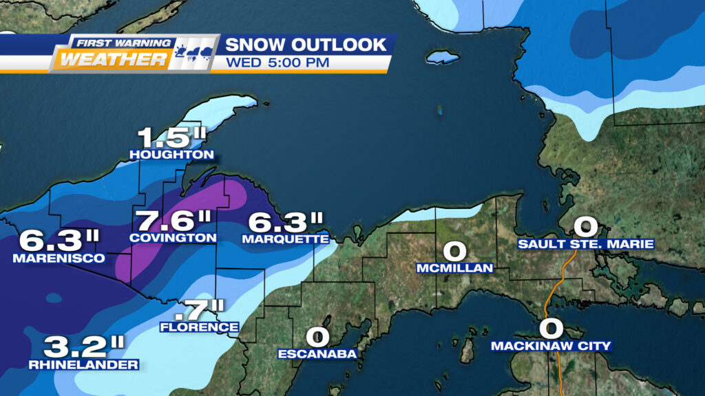
EXPECTED SNOWFALL FROM DAYBREAK WEDNESDAY TO 5PM. IT WILL BE A HEAVIER, WET SNOW